Historic State Map - Maryland - Lucas 1841 - Vintage Wall Art
Historic State Map - Maryland - Lucas 1841 - Vintage Wall Art


Product Number: SKU:MDZZ0021-2
Shipping: print gets shipped rolled
Couldn't load pickup availability

-
Description
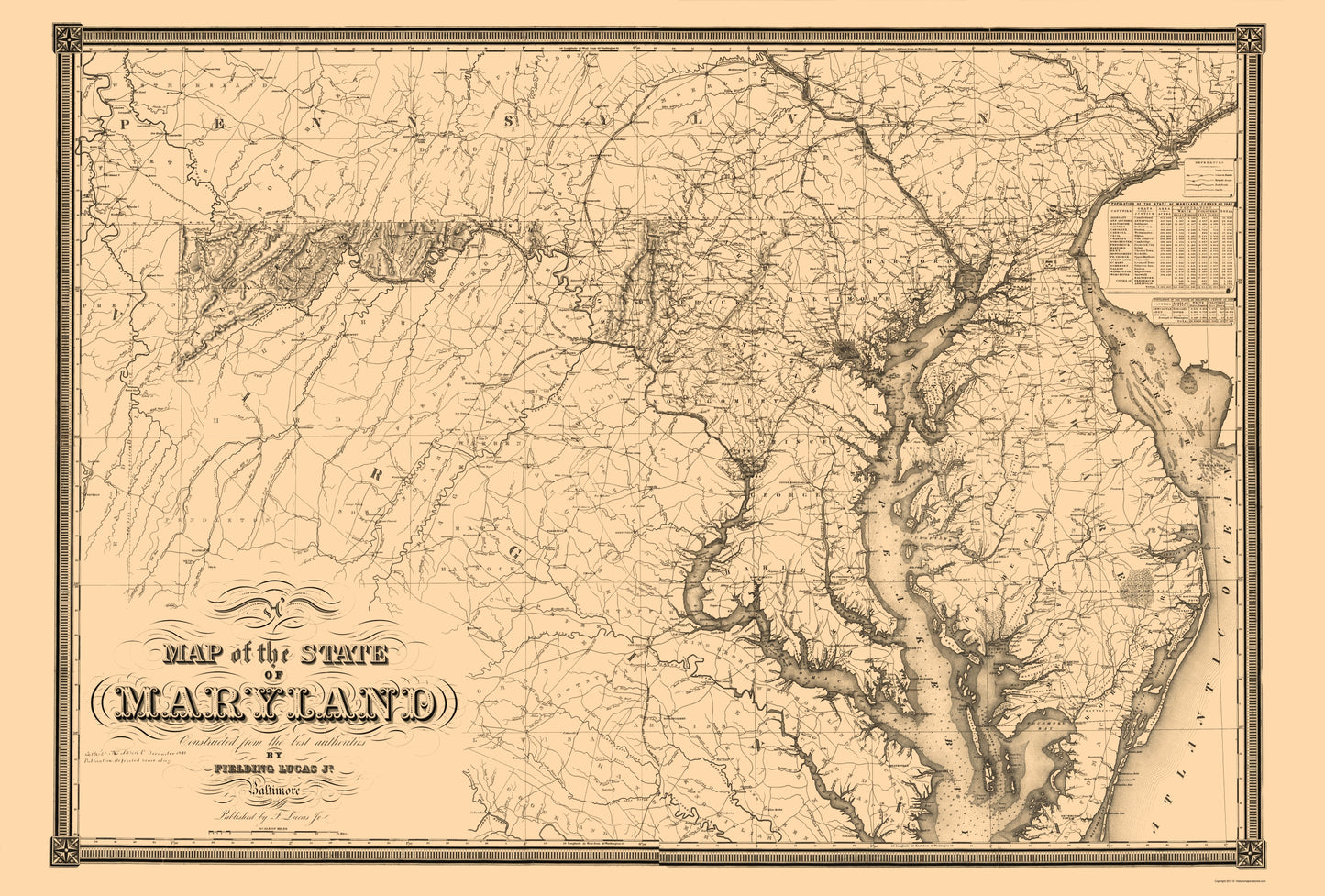
Old State Map - Maryland - Lucas 1841 - This is an exquisite full-color Reproduction printed on high-quality gloss paper, art paper or canvas.
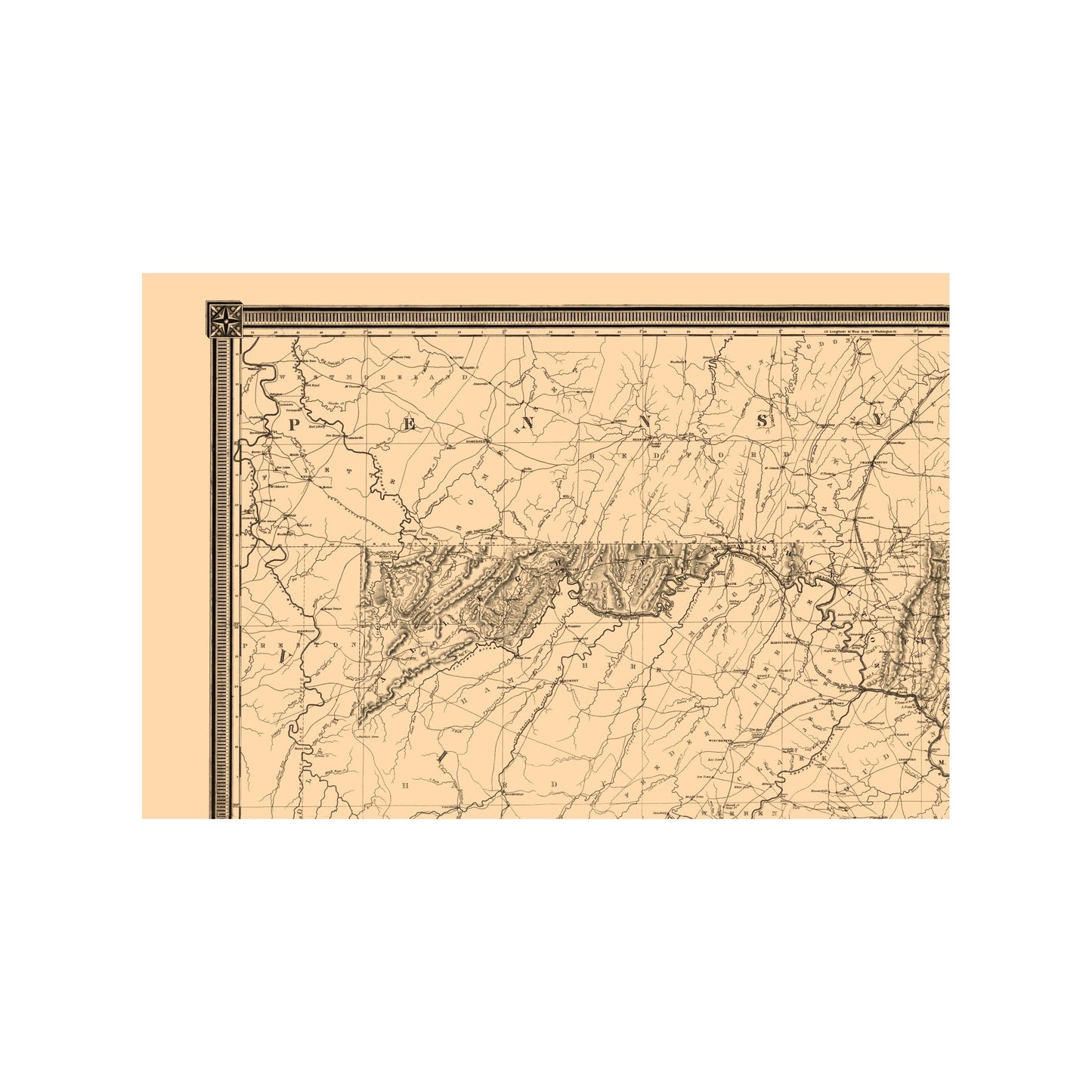
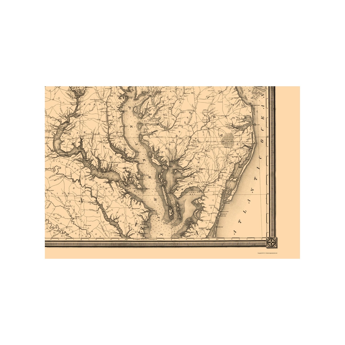
Sites and Townships Specific To This Map Are: Washington D. C., George Town, Bladensburg, Baltimore, Annapolis, Upper Marlboro, Frostburg, Cumberland, Cambridge and many more.
The following towns are featured: Map of Maryland with individual counties distinguished. The counties include: Alleghany, Washington, Fredrick, Carroll, Baltimore, Harford, Cecil, Ann Arundel, Montgomery, Prince George, Calvert, Charles, St. Marys, Kent, Queen Ann, Kent Island, Talbot, Caroline, Dorchester, Somerset and Worcester. Notable features are: Chesapeake Bay, Kent Island, Hoopers Island, Tangier Sound, Susquehanna River, Patapsco River, Patuxent River, Potomac River, Choptank River, Chester River, Cypress Swamp, Great Savage Mountains, South Mountains, Annapolis Railroad, Washington Railroad, Baltimore and Susquehanna Railroad and many roads. On the right side of the map is a reference for types of roads, the 1840 State of Maryland Census, and the 1840 State of Delaware census. In the bottom left corner is a scale of miles. Th
SKU: MDZZ0021
Original Maps are often difficult to find and usually have fold lines, identifying stamps or markings, tears, ragged edges, and assorted other natural signs of age that detract from their beauty. All of our maps have been professionally restored to depict their original beauty, while keeping all historical data intact.
These maps are fabulous pieces of history full of information useful to Historians, Genealogists, Cartographers, Relic Hunters, & Others. They make fascinating conversation pieces and splendid works of art for the home or office. -
Bullet Points
-
Print Quality Details
Giclée Printing Process
“A giclée (zhee-clay) reproduction is the closest duplication of an original artwork that is humanly or technically achievable. We have used the giclee printing process on both the Ultrasmooth Fine Art Paper and the Cotton Canvas options to create truly magnificent map prints, the quality of which is recognized by museums and galleries around the world. Read more about Giclee Prints here.
Glossy Satin Photo
This is a very high quality, photo-grade, 8 mil thick paper. It is considered a "matte" finish, however it does have a slight sheen to it. It is a very nice paper and produces extremely attractive maps.
Matte Art
This archival fine-art media has the look and feel of old-world handmade paper and is great for producing sharp, accurate reproductions. The Giclee process, combined with a 8 mil thick paper, creates magnificent historical maps guaranteed not to fade, yellow, or crack for more than 100 years. The quality of these matte-finish maps is recognized by museums and galleries around the world.
Sites and Townships Specific To This Map Are: Washington D. C., George Town, Bladensburg, Baltimore, Annapolis, Upper Marlboro, Frostburg, Cumberland, Cambridge and many more.
The following towns are featured: Map of Maryland with individual counties distinguished. The counties include: Alleghany, Washington, Fredrick, Carroll, Baltimore, Harford, Cecil, Ann Arundel, Montgomery, Prince George, Calvert, Charles, St. Marys, Kent, Queen Ann, Kent Island, Talbot, Caroline, Dorchester, Somerset and Worcester. Notable features are: Chesapeake Bay, Kent Island, Hoopers Island, Tangier Sound, Susquehanna River, Patapsco River, Patuxent River, Potomac River, Choptank River, Chester River, Cypress Swamp, Great Savage Mountains, South Mountains, Annapolis Railroad, Washington Railroad, Baltimore and Susquehanna Railroad and many roads. On the right side of the map is a reference for types of roads, the 1840 State of Maryland Census, and the 1840 State of Delaware census. In the bottom left corner is a scale of miles. Th
SKU: MDZZ0021
Original Maps are often difficult to find and usually have fold lines, identifying stamps or markings, tears, ragged edges, and assorted other natural signs of age that detract from their beauty. All of our maps have been professionally restored to depict their original beauty, while keeping all historical data intact.
These maps are fabulous pieces of history full of information useful to Historians, Genealogists, Cartographers, Relic Hunters, & Others. They make fascinating conversation pieces and splendid works of art for the home or office.
Giclée Printing Process
“A giclée (zhee-clay) reproduction is the closest duplication of an original artwork that is humanly or technically achievable. We have used the giclee printing process on both the Ultrasmooth Fine Art Paper and the Cotton Canvas options to create truly magnificent map prints, the quality of which is recognized by museums and galleries around the world. Read more about Giclee Prints here.
Glossy Satin Photo
This is a very high quality, photo-grade, 8 mil thick paper. It is considered a "matte" finish, however it does have a slight sheen to it. It is a very nice paper and produces extremely attractive maps.
Matte Art
This archival fine-art media has the look and feel of old-world handmade paper and is great for producing sharp, accurate reproductions. The Giclee process, combined with a 8 mil thick paper, creates magnificent historical maps guaranteed not to fade, yellow, or crack for more than 100 years. The quality of these matte-finish maps is recognized by museums and galleries around the world.