Historical Civil War Map - North Carolina Burnside Expedition Route - Foster 1866 - WallArt
Historical Civil War Map - North Carolina Burnside Expedition Route - Foster 1866 - WallArt


Product Number: SKU:CWBU0004-2
Shipping: print gets shipped rolled
Couldn't load pickup availability

-
Description
Civil War Map - Burnside Expedition Route North Carolina - 1866 - This is an exquisite full-color Reproduction printed on high-quality gloss paper, art paper or canvas.
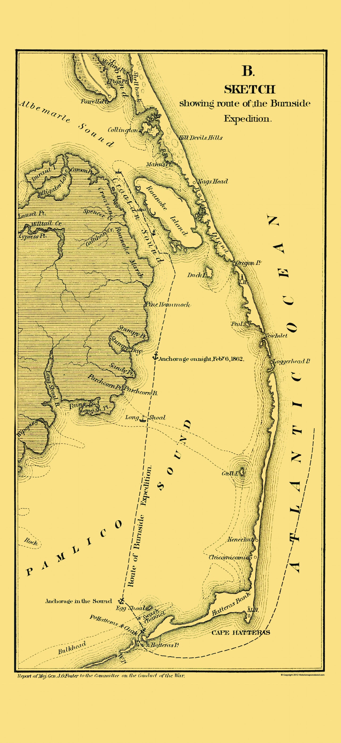
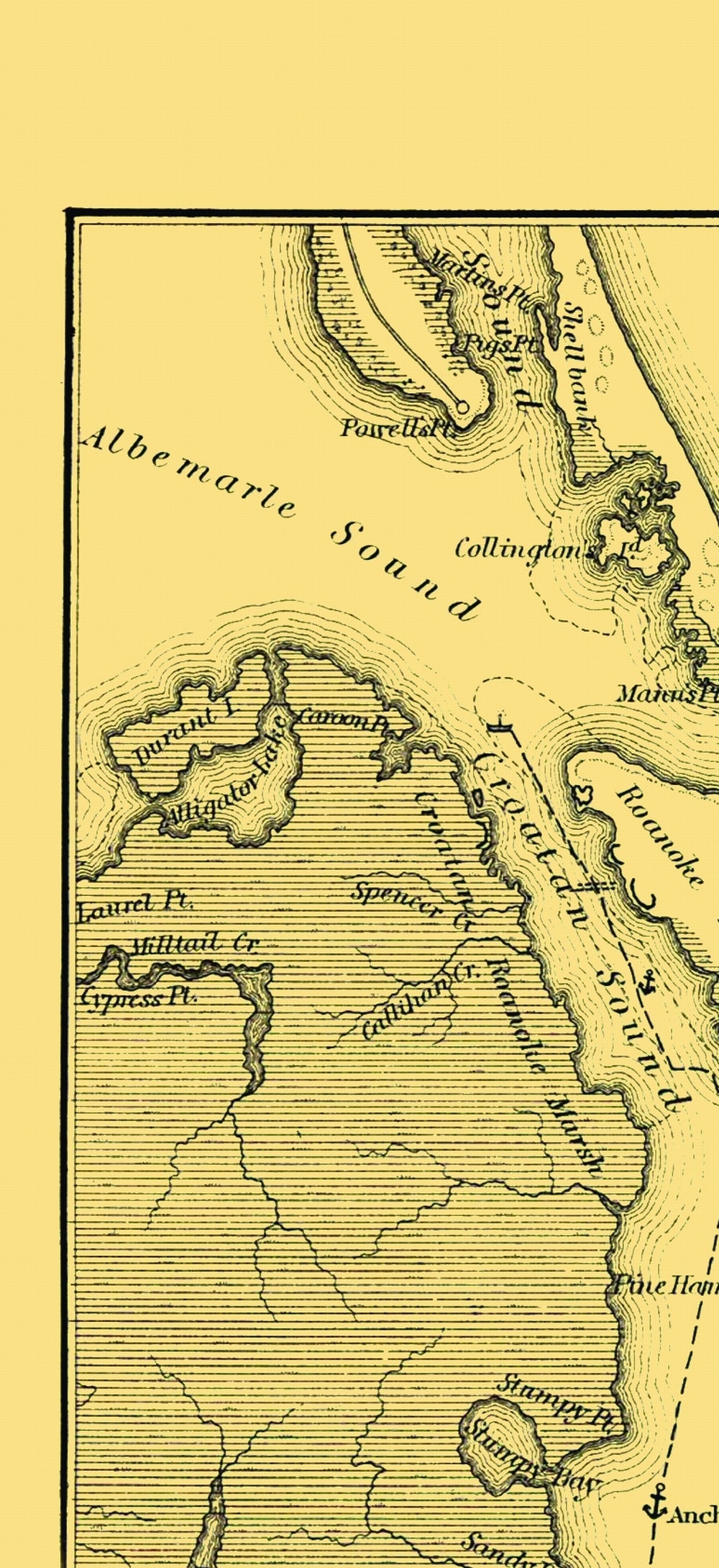
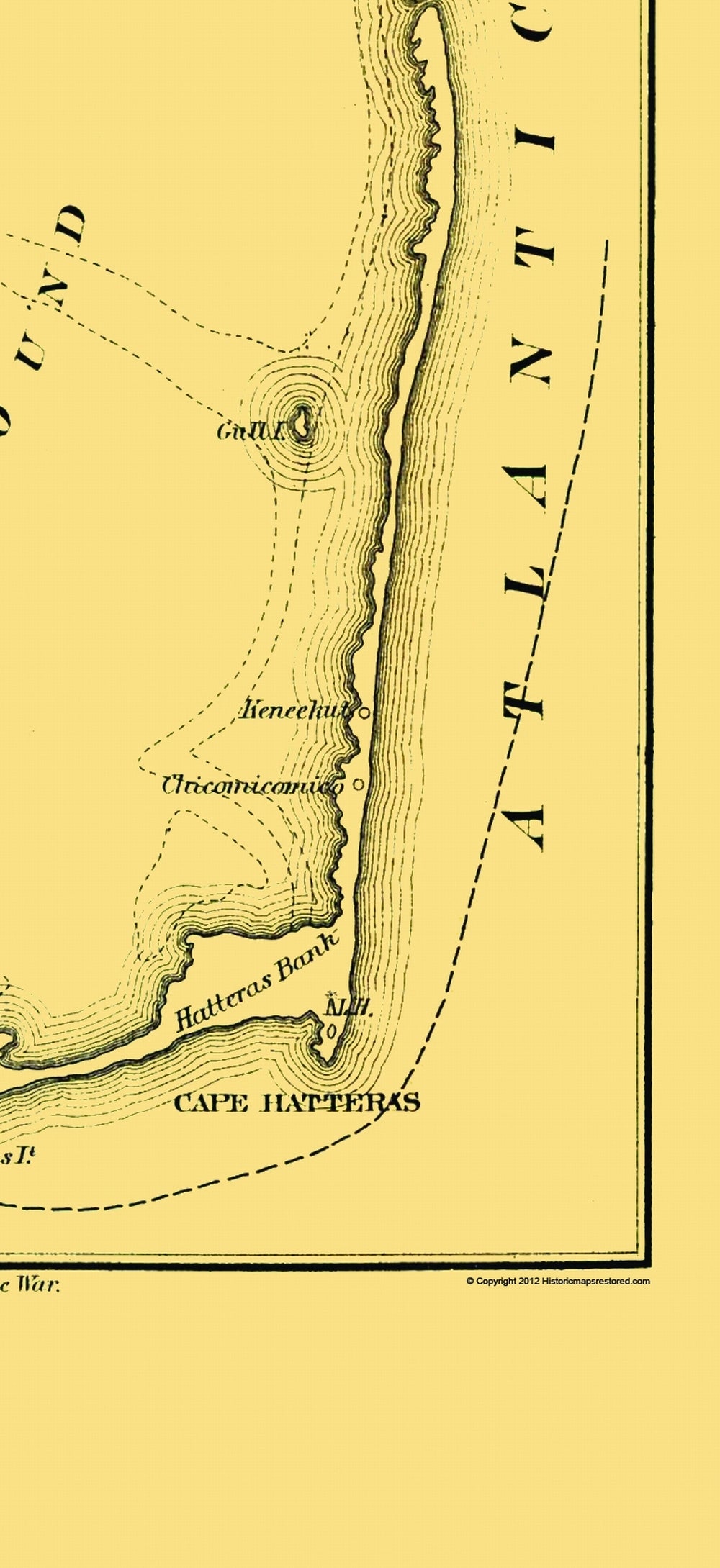
Sites and Townships Specific To This Map Are: Nags Head, Kill Devils Hills, and others.
The following towns are featured: Burnside set about recruiting regiments from states along the North Atlantic sea coast intending to make use of their familiarity with the sea. His army, known as the Coast Division, was divided into three brigades, each commanded by a friend of BurnsideÃs from his days at West Point. The first brigade was commanded by Brig. Gen. John G. Foster, the second by Brig. Gen. Jesse L. Reno and the third by Brig. Gen. John G. Parke. In January, 1862 Burnside set out from Fort Monroe and rendezvoused with Flag Officer Louis M. Goldsborough at recently captured Hatteras Inlet where the two assembled their forces. BurnsideÃs first objective was the Confederate fortifications on Roanoke Island guarding Albemarle Sound. Historical points include Cape Hatteras, Hatteras Bank, Pamlico Sound, Croatan Sound, Albemarle Sound, and others. Anchor locations are shown, as well as dotted lin
SKU: CWBU0004
Original Maps are often difficult to find and usually have fold lines, identifying stamps or markings, tears, ragged edges, and assorted other natural signs of age that detract from their beauty. All of our maps have been professionally restored to depict their original beauty, while keeping all historical data intact.
These maps are fabulous pieces of history full of information useful to Historians, Genealogists, Cartographers, Relic Hunters, & Others. They make fascinating conversation pieces and splendid works of art for the home or office. -
Bullet Points
-
Print Quality Details
Giclée Printing Process
“A giclée (zhee-clay) reproduction is the closest duplication of an original artwork that is humanly or technically achievable. We have used the giclee printing process on both the Ultrasmooth Fine Art Paper and the Cotton Canvas options to create truly magnificent map prints, the quality of which is recognized by museums and galleries around the world. Read more about Giclee Prints here.
Glossy Satin Photo
This is a very high quality, photo-grade, 8 mil thick paper. It is considered a "matte" finish, however it does have a slight sheen to it. It is a very nice paper and produces extremely attractive maps.
Matte Art
This archival fine-art media has the look and feel of old-world handmade paper and is great for producing sharp, accurate reproductions. The Giclee process, combined with a 8 mil thick paper, creates magnificent historical maps guaranteed not to fade, yellow, or crack for more than 100 years. The quality of these matte-finish maps is recognized by museums and galleries around the world.
Sites and Townships Specific To This Map Are: Nags Head, Kill Devils Hills, and others.
The following towns are featured: Burnside set about recruiting regiments from states along the North Atlantic sea coast intending to make use of their familiarity with the sea. His army, known as the Coast Division, was divided into three brigades, each commanded by a friend of BurnsideÃs from his days at West Point. The first brigade was commanded by Brig. Gen. John G. Foster, the second by Brig. Gen. Jesse L. Reno and the third by Brig. Gen. John G. Parke. In January, 1862 Burnside set out from Fort Monroe and rendezvoused with Flag Officer Louis M. Goldsborough at recently captured Hatteras Inlet where the two assembled their forces. BurnsideÃs first objective was the Confederate fortifications on Roanoke Island guarding Albemarle Sound. Historical points include Cape Hatteras, Hatteras Bank, Pamlico Sound, Croatan Sound, Albemarle Sound, and others. Anchor locations are shown, as well as dotted lin
SKU: CWBU0004
Original Maps are often difficult to find and usually have fold lines, identifying stamps or markings, tears, ragged edges, and assorted other natural signs of age that detract from their beauty. All of our maps have been professionally restored to depict their original beauty, while keeping all historical data intact.
These maps are fabulous pieces of history full of information useful to Historians, Genealogists, Cartographers, Relic Hunters, & Others. They make fascinating conversation pieces and splendid works of art for the home or office.
Giclée Printing Process
“A giclée (zhee-clay) reproduction is the closest duplication of an original artwork that is humanly or technically achievable. We have used the giclee printing process on both the Ultrasmooth Fine Art Paper and the Cotton Canvas options to create truly magnificent map prints, the quality of which is recognized by museums and galleries around the world. Read more about Giclee Prints here.
Glossy Satin Photo
This is a very high quality, photo-grade, 8 mil thick paper. It is considered a "matte" finish, however it does have a slight sheen to it. It is a very nice paper and produces extremely attractive maps.
Matte Art
This archival fine-art media has the look and feel of old-world handmade paper and is great for producing sharp, accurate reproductions. The Giclee process, combined with a 8 mil thick paper, creates magnificent historical maps guaranteed not to fade, yellow, or crack for more than 100 years. The quality of these matte-finish maps is recognized by museums and galleries around the world.