Railroad Map - Denver and Rio Grande Railway - Rand McNally 1886 - Vintage Wall Art
Railroad Map - Denver and Rio Grande Railway - Rand McNally 1886 - Vintage Wall Art


Product Number: SKU:NMZZ0042-2
Shipping: print gets shipped rolled
Couldn't load pickup availability


-
Description
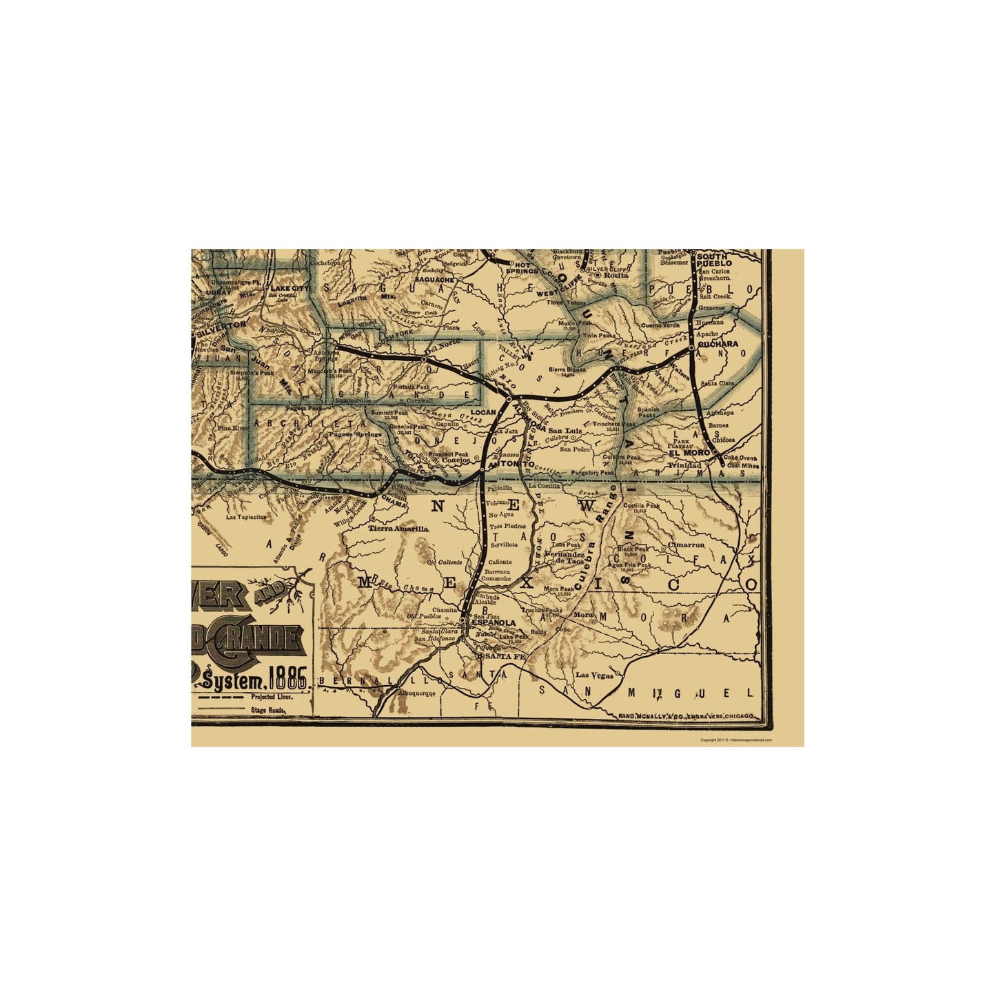
Old Railroad Map - Denver and Rio Grande Railway 1886 - This is an exquisite full-color Reproduction printed on high-quality gloss paper, art paper or canvas.
Sites and Townships Specific To This Map Are: Leadville, Buena Vista, Salida, Canon City, Red Cliff, Frisco, Dillon, Georgetown, Wheeler, Koeme, Robinson, Freemont Pass, Birds Eye, Malta, Crystal Lake, Granite, Pine Creek, Riverside, Americus, Dornic, Calumet, Heels, Harp, Nathrop, Bonanza and many others.
The following towns are featured: Featured are the counties of Routt, Garfield, Delta, Eagle, Summit, Grand, Larimer, Boulder, Bilpin, Clear Creek, South Park, Weld, Arapahoe, Elber, Douglas, El Paso, Freemont, Pueblo, Custer, Huerfano, Las Animas, Costilla, Rio Grande, Saguache, Conejos, Taos, Archuleta, Hinsdale, San Juan, La Plata, Dolores, Kane, Iron, Millard and many others. Also shown are the San Rafael River, Dirty Devil River, Grand River, Rio Dolores, Rio Grande, Rio San Miguel, Rio San Juan, Rio Nutria, Rio Piedro, San Luis River, Platte River, Blue River, Piney River, Plateau Creek, Lagarita Creek, Muddy Creek, Salt Creek, Huerfano Creek, Elder Creek, Uintah Mountains, Wahsat
SKU: NMZZ0042
Original Maps are often difficult to find and usually have fold lines, identifying stamps or markings, tears, ragged edges, and assorted other natural signs of age that detract from their beauty. All of our maps have been professionally restored to depict their original beauty, while keeping all historical data intact.
These maps are fabulous pieces of history full of information useful to Historians, Genealogists, Cartographers, Relic Hunters, & Others. They make fascinating conversation pieces and splendid works of art for the home or office. -
Bullet Points
-
Print Quality Details
Giclée Printing Process
“A giclée (zhee-clay) reproduction is the closest duplication of an original artwork that is humanly or technically achievable. We have used the giclee printing process on both the Ultrasmooth Fine Art Paper and the Cotton Canvas options to create truly magnificent map prints, the quality of which is recognized by museums and galleries around the world. Read more about Giclee Prints here.
Glossy Satin Photo
This is a very high quality, photo-grade, 8 mil thick paper. It is considered a "matte" finish, however it does have a slight sheen to it. It is a very nice paper and produces extremely attractive maps.
Matte Art
This archival fine-art media has the look and feel of old-world handmade paper and is great for producing sharp, accurate reproductions. The Giclee process, combined with a 8 mil thick paper, creates magnificent historical maps guaranteed not to fade, yellow, or crack for more than 100 years. The quality of these matte-finish maps is recognized by museums and galleries around the world.
Sites and Townships Specific To This Map Are: Leadville, Buena Vista, Salida, Canon City, Red Cliff, Frisco, Dillon, Georgetown, Wheeler, Koeme, Robinson, Freemont Pass, Birds Eye, Malta, Crystal Lake, Granite, Pine Creek, Riverside, Americus, Dornic, Calumet, Heels, Harp, Nathrop, Bonanza and many others.
The following towns are featured: Featured are the counties of Routt, Garfield, Delta, Eagle, Summit, Grand, Larimer, Boulder, Bilpin, Clear Creek, South Park, Weld, Arapahoe, Elber, Douglas, El Paso, Freemont, Pueblo, Custer, Huerfano, Las Animas, Costilla, Rio Grande, Saguache, Conejos, Taos, Archuleta, Hinsdale, San Juan, La Plata, Dolores, Kane, Iron, Millard and many others. Also shown are the San Rafael River, Dirty Devil River, Grand River, Rio Dolores, Rio Grande, Rio San Miguel, Rio San Juan, Rio Nutria, Rio Piedro, San Luis River, Platte River, Blue River, Piney River, Plateau Creek, Lagarita Creek, Muddy Creek, Salt Creek, Huerfano Creek, Elder Creek, Uintah Mountains, Wahsat
SKU: NMZZ0042
Original Maps are often difficult to find and usually have fold lines, identifying stamps or markings, tears, ragged edges, and assorted other natural signs of age that detract from their beauty. All of our maps have been professionally restored to depict their original beauty, while keeping all historical data intact.
These maps are fabulous pieces of history full of information useful to Historians, Genealogists, Cartographers, Relic Hunters, & Others. They make fascinating conversation pieces and splendid works of art for the home or office.
Giclée Printing Process
“A giclée (zhee-clay) reproduction is the closest duplication of an original artwork that is humanly or technically achievable. We have used the giclee printing process on both the Ultrasmooth Fine Art Paper and the Cotton Canvas options to create truly magnificent map prints, the quality of which is recognized by museums and galleries around the world. Read more about Giclee Prints here.
Glossy Satin Photo
This is a very high quality, photo-grade, 8 mil thick paper. It is considered a "matte" finish, however it does have a slight sheen to it. It is a very nice paper and produces extremely attractive maps.
Matte Art
This archival fine-art media has the look and feel of old-world handmade paper and is great for producing sharp, accurate reproductions. The Giclee process, combined with a 8 mil thick paper, creates magnificent historical maps guaranteed not to fade, yellow, or crack for more than 100 years. The quality of these matte-finish maps is recognized by museums and galleries around the world.