Topographical Map - Part of Sierra Nevada California - Whitney 1867 - Vintage Wall Art
Topographical Map - Part of Sierra Nevada California - Whitney 1867 - Vintage Wall Art


Product Number: SKU:NVSI0002-2
Shipping: print gets shipped rolled
Couldn't load pickup availability
-
Description
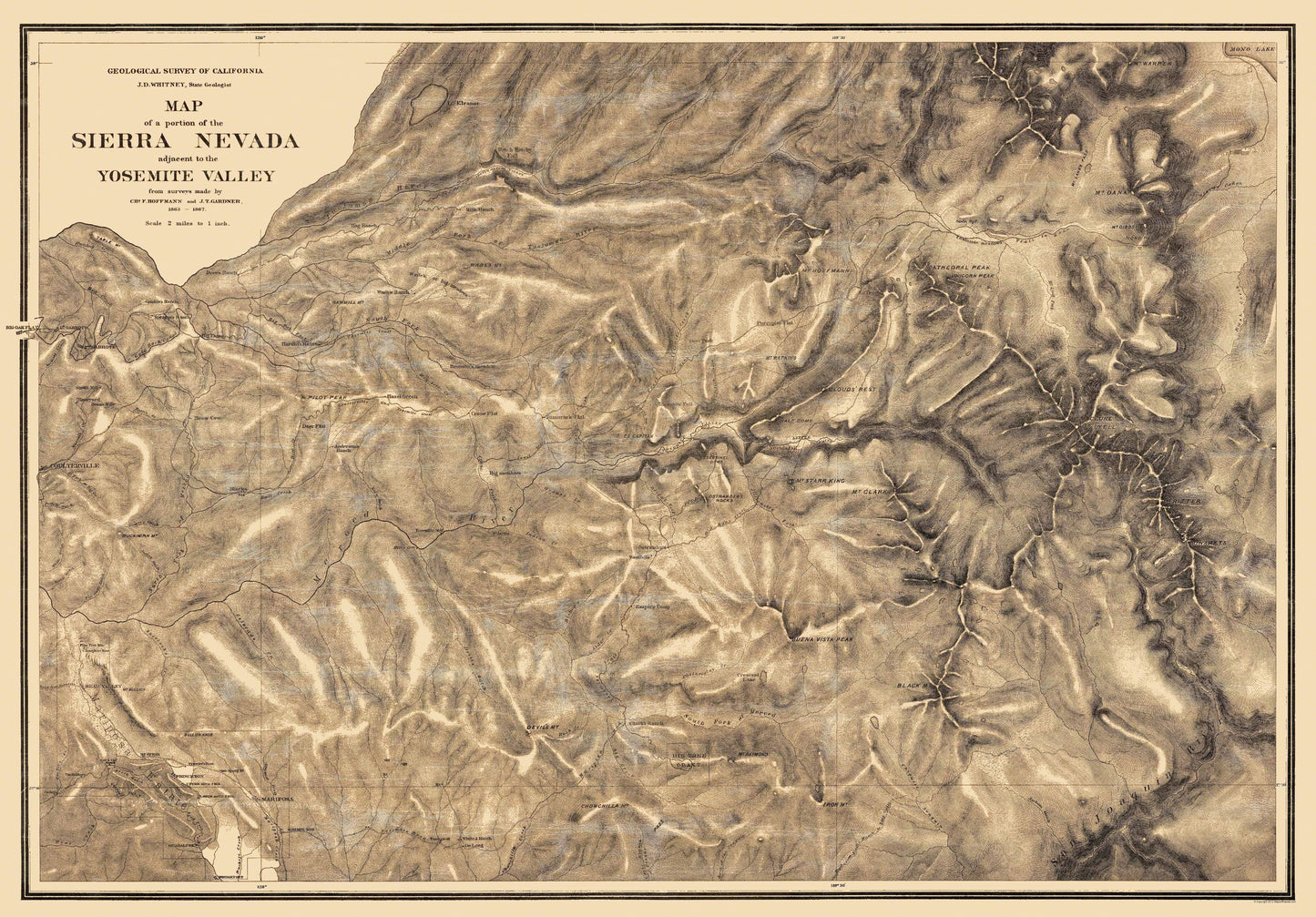
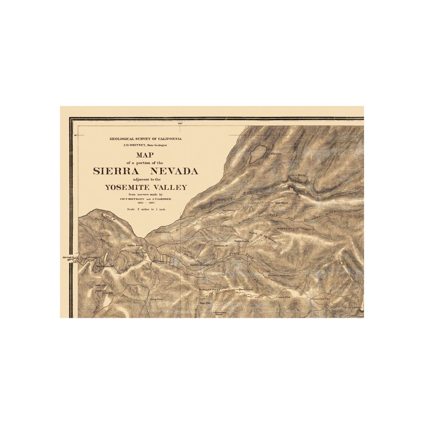
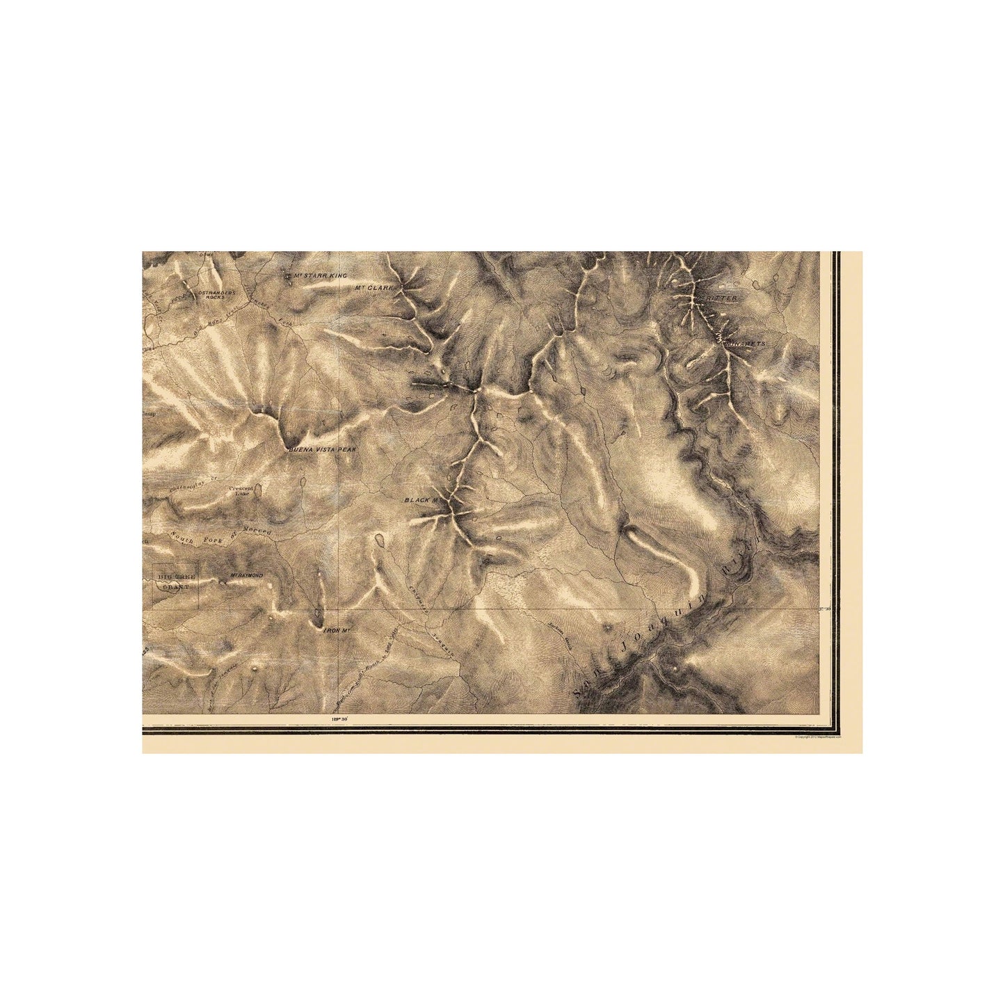
Topographical Map - Part of Sierra Nevada California - Whitney 1867 - This is an exquisite full-color Reproduction printed on high-quality gloss paper, art paper or canvas.
Sites and Townships Specific To This Map Are: Table Mountain, Gambles Ranch, Spragues Ranch, Gold Rock Canal, 1st Garrote , 2nd Garrote, Smith Mill, Beans Mill, Hog Ranch, Drews Ranch, Sawmill Mountain, Hardins Ranch, Pilot Peak, Andersons Ranch, Big Oak Flat, Boneyard, Buckhorn Mountain, Pine Tree Mine, Josephine Mine, Mt. Bullion, Mariposa Estate, Mt. Ophir, Coulterville & Yosemite Trail, Big Oak Flat and Yosemite Trail, Wades Ranch, Tuolumne River, Wades or Big Meadows, Wades Mt., Milk Ranch, Big Meadows, Yosemite Mill, Devils Mountain, Yosemite Road, Chowchilla Mt., Clarks Ranch, Empire Camp, Tamarack Flat, El Capitan, Hetch Hetchy Fall, Mt. Hoffman, Porcupine Flat, Mt. Conne, Soda Springs, Tuolumne Meadows, Cathedral Peak, Unicorn Peak, Black Mt., Juaquin River, Minarets, Mt. Ritter, Mt. Lyell, Maclure, Mt. Gibbs, Mt. Dana, McLanes Pass, Mt. Warren, Mono Lake, plus many creeks, gulches.
The following towns are featured: Coulterville, Bear Valley, Mariposa, Merced River, Blacks, Thom
SKU: NVSI0002
Original Maps are often difficult to find and usually have fold lines, identifying stamps or markings, tears, ragged edges, and assorted other natural signs of age that detract from their beauty. All of our maps have been professionally restored to depict their original beauty, while keeping all historical data intact.
These maps are fabulous pieces of history full of information useful to Historians, Genealogists, Cartographers, Relic Hunters, & Others. They make fascinating conversation pieces and splendid works of art for the home or office. -
Bullet Points
-
Print Quality Details
Giclée Printing Process
“A giclée (zhee-clay) reproduction is the closest duplication of an original artwork that is humanly or technically achievable. We have used the giclee printing process on both the Ultrasmooth Fine Art Paper and the Cotton Canvas options to create truly magnificent map prints, the quality of which is recognized by museums and galleries around the world. Read more about Giclee Prints here.
Glossy Satin Photo
This is a very high quality, photo-grade, 8 mil thick paper. It is considered a "matte" finish, however it does have a slight sheen to it. It is a very nice paper and produces extremely attractive maps.
Matte Art
This archival fine-art media has the look and feel of old-world handmade paper and is great for producing sharp, accurate reproductions. The Giclee process, combined with a 8 mil thick paper, creates magnificent historical maps guaranteed not to fade, yellow, or crack for more than 100 years. The quality of these matte-finish maps is recognized by museums and galleries around the world.
Sites and Townships Specific To This Map Are: Table Mountain, Gambles Ranch, Spragues Ranch, Gold Rock Canal, 1st Garrote , 2nd Garrote, Smith Mill, Beans Mill, Hog Ranch, Drews Ranch, Sawmill Mountain, Hardins Ranch, Pilot Peak, Andersons Ranch, Big Oak Flat, Boneyard, Buckhorn Mountain, Pine Tree Mine, Josephine Mine, Mt. Bullion, Mariposa Estate, Mt. Ophir, Coulterville & Yosemite Trail, Big Oak Flat and Yosemite Trail, Wades Ranch, Tuolumne River, Wades or Big Meadows, Wades Mt., Milk Ranch, Big Meadows, Yosemite Mill, Devils Mountain, Yosemite Road, Chowchilla Mt., Clarks Ranch, Empire Camp, Tamarack Flat, El Capitan, Hetch Hetchy Fall, Mt. Hoffman, Porcupine Flat, Mt. Conne, Soda Springs, Tuolumne Meadows, Cathedral Peak, Unicorn Peak, Black Mt., Juaquin River, Minarets, Mt. Ritter, Mt. Lyell, Maclure, Mt. Gibbs, Mt. Dana, McLanes Pass, Mt. Warren, Mono Lake, plus many creeks, gulches.
The following towns are featured: Coulterville, Bear Valley, Mariposa, Merced River, Blacks, Thom
SKU: NVSI0002
Original Maps are often difficult to find and usually have fold lines, identifying stamps or markings, tears, ragged edges, and assorted other natural signs of age that detract from their beauty. All of our maps have been professionally restored to depict their original beauty, while keeping all historical data intact.
These maps are fabulous pieces of history full of information useful to Historians, Genealogists, Cartographers, Relic Hunters, & Others. They make fascinating conversation pieces and splendid works of art for the home or office.
Giclée Printing Process
“A giclée (zhee-clay) reproduction is the closest duplication of an original artwork that is humanly or technically achievable. We have used the giclee printing process on both the Ultrasmooth Fine Art Paper and the Cotton Canvas options to create truly magnificent map prints, the quality of which is recognized by museums and galleries around the world. Read more about Giclee Prints here.
Glossy Satin Photo
This is a very high quality, photo-grade, 8 mil thick paper. It is considered a "matte" finish, however it does have a slight sheen to it. It is a very nice paper and produces extremely attractive maps.
Matte Art
This archival fine-art media has the look and feel of old-world handmade paper and is great for producing sharp, accurate reproductions. The Giclee process, combined with a 8 mil thick paper, creates magnificent historical maps guaranteed not to fade, yellow, or crack for more than 100 years. The quality of these matte-finish maps is recognized by museums and galleries around the world.